
The Surface Water Data Viewer provides a window into Wisconsin DNR water-related data holdings, including the Wisconsin Wetlands Inventory. This represents a significant leap forward in making digital WWI maps available to a broader audience.
Digital WWI data are currently available for the majority of counties in Wisconsin (see DNR status map). The migration from paper inventory maps is a work in progress for DNR staff, with 15 counties in the queue for the digital conversion. At this time, 12 counties have been rectified to an orthophoto base. The remainder are referenced to non-orthorectified air photos, resulting in some positional displacements when overlaid on high-resolution orthophotography (see DNR disclaimer).
In addition to the wetlands inventory, quite a range of other data are available in the application. The state boating ordinances layer will be of interest to boaters planning a future trip, while anglers will find value in the Musky, Walleye, Smallmouth Bass and trout streams data. Assesment and regulatory data are also available, including, for example, aquatic invasive species distributions.
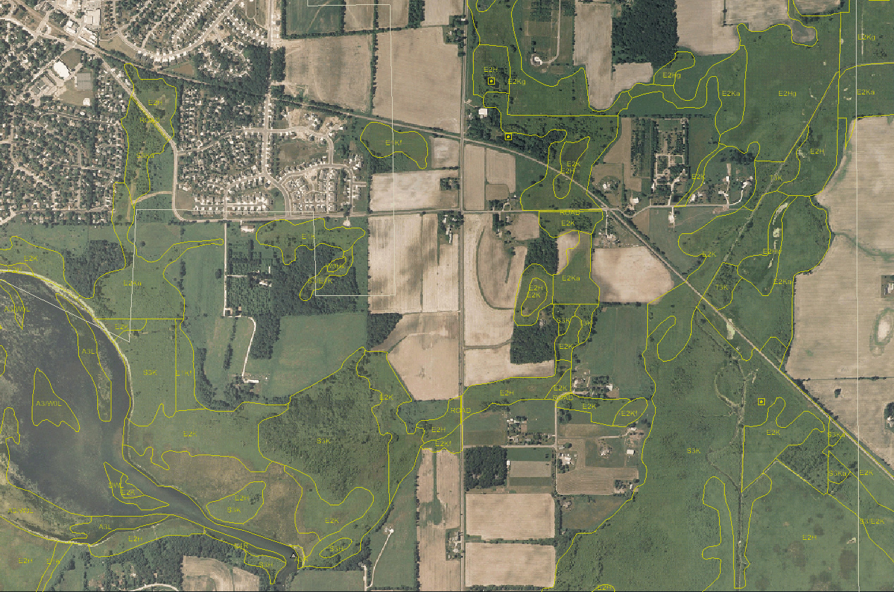
Wisconsin Wetlands Inventory in southeastern
Dane County over USDA digital air photo.
(click for larger view)
The SWDV application is actually comprised of four “themes”, each focused on specific water-related topics. The default SWDV theme contains a range of general-interest data layers, while a “dam safety” theme lets you view and query a DNR dams database. Floodplain, and Designated Waters (critical habitat and other sensitive aquatic resource areas) themes are also available.
“Find Location” tool worth a look
The SWDV “find location” tool offers a slick way to search on some unique features you won’t find in mainstream mapping applications (Google Maps, Mapquest, etc.) Among the 14 different options you’ll find searches by map coordinate (lat/long, WTM, UTM), lake or river name, township/range/section, and civil towns. This is a great little tool to bookmark for future reference.
While the “extract layer to shapefile” button found on the advanced toolbar doesn’t let you download WWI data, savvy ArcGIS users familiar with consuming ESRI map services can point their ArcMap session at the “WiDNR_SurfaceWaterViewer” service on dnrmaps.wisconsin.gov.
Anyone interested in DNR water-related information should definitely give the Surface Water Data Viewer a whirl!