
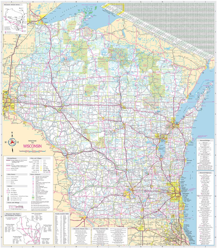
The Wisconsin Department of Transportation (WiSDOT) is looking for public input on the design and content of the official State Highway Map. A new, updated edition of the highway map will appear in 2025.
 Katie Ginther, WisDOT’s Cartographic Specialist responsible for producing the highway map, and David Layton, Section Chief for Surveying and Mapping at WisDOT, appeared on Wisconsin’s Public Radio’s Morning Show on February 6, 2024.
WisDOT is interested in public input on many aspects of the map, including the level of detail, map legibility, map design including colors and fonts, and layout elements such as the mileage chart and insets. In addition, the agency is looking for ideas on other map products that could be derived from the highway map.
WisDOT distributes over 400,000 copies of the Highway Map each year.
An online survey is available to those who would like to comment. The survey, which can be found here on the WisDOT State Highway Map webpage, is open through the end of February. So far, over 700 people have submitted comments.
The 2025 edition of the highway map is the first time WisDOT will use GIS to produce the map. As Ginther explained during the Morning Show segment, GIS allows for much more efficient updating of data, compared to the methods currently used. There are over fifty layers of content on the map (roads, cities and villages, lakes, rivers, points of interest, etc.). Using spatially accurate GIS data means these layers to be updated from the most current sources.
The Morning Show segment, hosted by Kate Archer Kent, is archived here.