
BCPL teamed up with the University of Wisconsin to create the public land survey records site
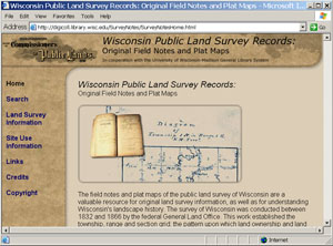
Ever wondered what Wisconsin looked like before it was settled? The Board of Commissioners of Public Lands (BCPL) in cooperation with the University of Wisconsin library system now provides online access to the original notebooks and plat maps from the first land survey of Wisconsin. The notebooks, called field notes, were originally scanned and made available online in 2004 by BCPL. Now the associated plat maps have been scanned and integrated with these field notes. Both are freely available to the public for viewing online at: http://digicoll.library.wisc.edu/SurveyNotes/SurveyNotesHome.html
The land now called the state of Wisconsin was originally surveyed by the federal government between 1833 and 1866. During this time land surveyors under contract to the federal government divided the vast public domain lands of the region into small lots for sale and management. The system they used was the Public Land Survey System, or PLSS (see additional resources below for more information), and forms the basis for legal descriptions of property in Wisconsin. The PLSS essentially divided the state up into 1 mile by 1 mile ‘sections’. The surveys were recorded in small field notebooks, including legal descriptions, sketch maps, and general landscape descriptions.
The field notes are extremely valuable resources, but they are only the first part of the story. After the surveys, the field notebooks were sent to the Surveyor General’s office and cartographers translated them into plat maps. These maps were used by local and federal land offices as well as settlers and land speculators to aid in the sale, purchase and management of the resulting plots.
The original notes and maps are now primarily used by surveyors for locating original survey lines, but the information they contain has a much broader general interest as well.The original surveyors not only recorded the locations of survey lines and the landmarks necessary to identify these lines, they provided descriptions of the physical landscape as well. This could include soil types, the condition of the land, vegetation types, stream locations, lake and pond outlines, and evidence of human habitation like trails and cabins. These rich descriptions may be helpful in determining early human impacts on the landscape, and for creating human and physical landscape histories. And for anyone for anyone with an interest in Wisconsin history, they are fun to browse!
Using the site
The field notes and maps may be searched through specific township and range sections (indexes to the PLSS), or through a map interface. Each will take you to the field notes for a particular region, broken out by sections of the notebook. From here you can directly view specific survey lines, the general description of the region, small sketch maps, and the plat map. The immediate neighboring surveys are also easily accessible.
Once you have located a particular area of interest, a given township for example, reading the notes provides a look back in time. Original vegetation such as a landscape covered in white, black and burr oak trees are described, with a foreshadowing of the future in comments about the quality of the lumber. Patterns of landuse by early American Indians are inferred by references to “Indian paths” in the text and associated sketch maps.The terminology of the notebooks, as well as the specifics of the PLSS, are not always straightforward; I suggest you read the background material on the site before jumping into the notebooks. But as the site itself mentions, reading through the notebooks ultimately provides the best introduction to learning how to use this valuable resource.
PLSS Resources
http://sco.wisc.edu/plss/index.php
http://www.nationalatlas.gov/articles/boundaries/a_plss.html
Original Land Survey Resources
http://www.wisconsinhistory.org/localhistory/articles/surveyor.asp
http://www.wisconsinhistory.org/libraryarchives/maps/surveyors.asp
http://bcpl.state.wi.us/asx/index.asp